
Most Dangerous Roads to Drive on the Central Coast
What are the most dangerous roads to drive on the Central Coast?
Driving through the scenic roads of California’s Central Coast can be a truly breathtaking experience, but some roads are more treacherous than others. In Santa Barbara, San Luis Obispo, Monterey, Santa Cruz, and San Benito counties, certain roads are notorious for their danger. Let’s take a look at the ten most dangerous roads for automobile drivers in these counties, and what makes them so risky.
1. Highway 154 (San Marcos Pass) – Santa Barbara County
Highway 154, also known as San Marcos Pass, is a beautiful but perilous road that cuts through the Santa Ynez Mountains. This route offers stunning views but comes with sharp curves, steep drops, and frequent fog, which can make driving treacherous. The combination of high speeds and complex turns has led to numerous accidents over the years, earning it a reputation as one of the most dangerous roads in the area.
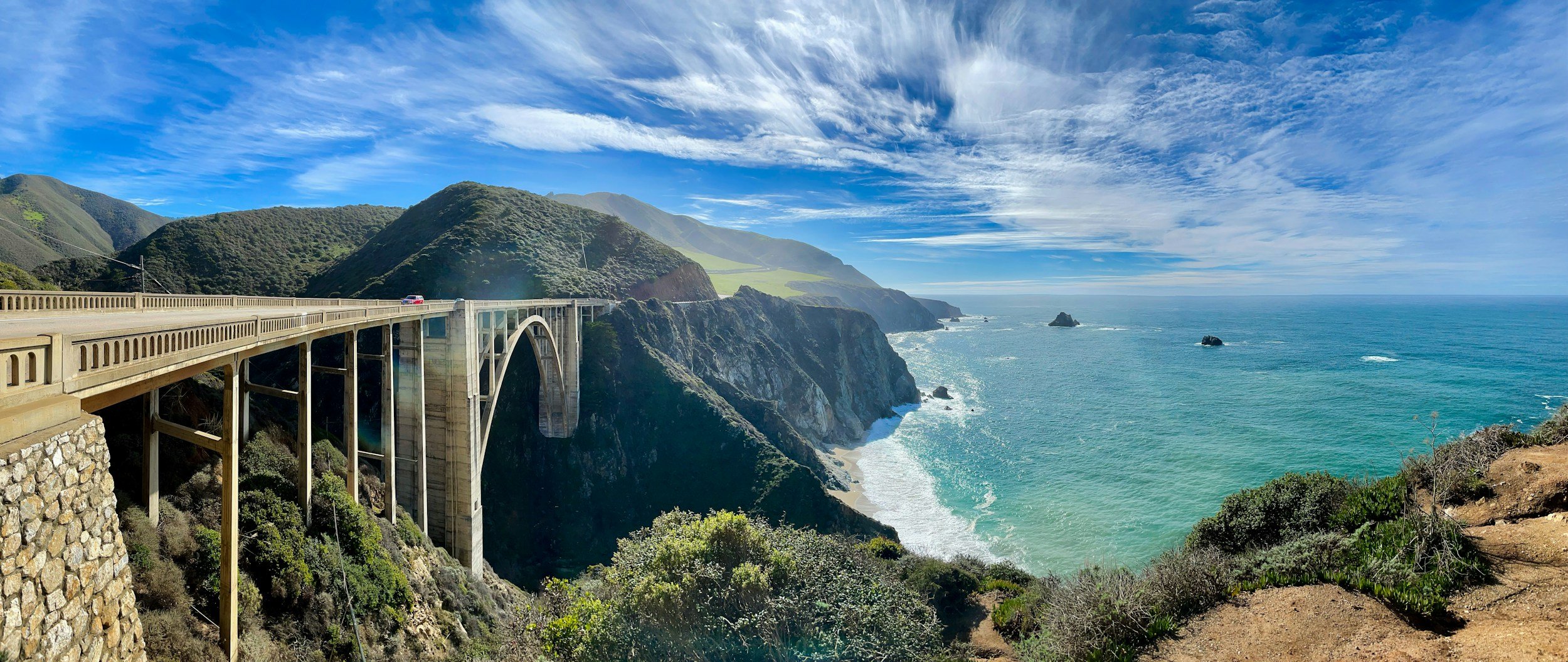
2. Highway 1 (Pacific Coast Highway) – Monterey County
The Pacific Coast Highway, particularly the stretch through Big Sur, is renowned for its dramatic scenery. However, its narrow lanes, tight turns, and sheer cliffs make it one of the most dangerous roads in California. Rockslides and unpredictable weather conditions, such as fog and high winds, add to the hazards. While the views are stunning, drivers must remain vigilant and focused on the road.
3. Highway 156/152 (Pacheco Pass) Monterey County, San Benito County
This thoroughfare connecting the Central Coast and the Central Valley is known for its sharp turns, narrow lanes, speeding drivers, and oversized trucks. Fatal accidents are common. The road’s challenging conditions require drivers to be highly skilled and cautious.
4. Highway 46 – San Luis Obispo County
Highway 46, linking Paso Robles to the coast, is infamous for high-speed traffic and blind curves. The road sees a mix of tourist traffic and local agricultural vehicles, creating a potentially hazardous environment. The rolling hills can obscure oncoming traffic, leading to numerous head-on collisions. Drivers need to be particularly careful and avoid speeding on this road.
5. Highway 17 – Santa Cruz County
Highway 17 connects the Central Coast to the Silicon Valley. It winds through the dense forests of the Santa Cruz Mountains, offering a picturesque but challenging drive. The road is too narrow, with tight curves and limited visibility, with a lot of traffic coming and going. Frequent fog and rain make the road slippery, and fallen branches or debris are common.
6. Highway 68 (Monterey Salinas Highway)– Monterey County
Highway 68 connects Salinas to Monterey, and Pacific Grove. It passes Laguna Seca Raceway and Laureles Grade into Carmel Valley. It offers bucolic views, of rolling hills, punctuated by coastal oaks and pines. But, twists and turns, interspersed with sudden stop lights, on this single lane road, without a divider, make it especially dangerous, especially during commuter hours.
7. Carmel Valley Road – Monterey County
Carmel Valley Road stretches from the coast into the hills, offering a mix of scenic beauty and rural charm. However, its narrow and winding nature, combined with local traffic, makes it hazardous. Frequent elevation changes and sharp curves require constant attention. The road is also popular with cyclists and pedestrians, adding another layer of complexity for drivers.
8. Santa Rosa Creek Road – San Luis Obispo County
Santa Rosa Creek Road is a secluded route through rolling hills and farmland. Its remote location means it’s not heavily trafficked, but this also means help can be far away in case of an accident. The road is narrow, with numerous blind corners and occasional livestock crossings. The uneven surface and lack of guardrails make it a challenging drive that requires careful navigation.
9. Bonny Doon Road – Santa Cruz County
Bonny Doon Road in the Santa Cruz Mountains is known for its sharp curves and steep drops. Frequent fog can limit visibility, and the road is often slick from rain. Wildlife crossings and fallen tree limbs add to the hazards. Drivers need to be vigilant and prepared for sudden changes in conditions, making this a road that requires extra caution.
10. U.S. 101 – San Benito County, Monterey County, San Luis Obispo County, Santa Barbara County
US 101, or The 101, depending on where you’re at, links Northern and Southern California. It’s heavily traveled by trucks, tourists and daily commuters. It cuts through Santa Barbara before traveling along the Gaviota Coast, before heading through the Gaviota Tunnel. It continues on through Buellton, Los Alamos, Orcutt, Santa Maria, and Nipomo. It rejoins with SR 1 between Pismo Beach and San Luis Obispo. It cuts through SLO, before the Cuesta Grade, and Paso Robles, before cutting through the Salinas Valley, and King City, Soledad, Salinas, and heading north toward Prunedale and ultimately San Francisco and the Golden Gate Bridge. Freeway speeds, frequent speeders, drunk drivers, and out of control trucks make this an especially dangerous road that links nearly the entire Central Coast together. Drivers should use caution whether they’re out an about running errands, or they’re on their way to San Francisco or Los Angeles.
Driving the roads of Santa Barbara, San Luis Obispo, Monterey, Santa Cruz, and San Benito counties can be an unforgettable experience, filled with breathtaking views and memorable moments. However, it's essential to respect the dangers these roads pose. By staying informed and practicing good driving habits, you can enjoy your journey while minimizing the risks. Safe travels and happy driving!